University of Minnesota
http://www.umn.edu/
612-625-5000
http://www.umn.edu/
612-625-5000
Minnesota Biodiversity Atlas
Bell Museum
Dataset: MIN-Bryophytes
Search Criteria: South Africa; excluding cultivated/captive occurrences
1
Page 1, records 1-15 of 15
Bell Museum bryophytes | |
 MIN:Bryophytes | 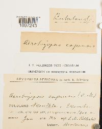 Aerobryopsis capensis (Müll. Hal.) M. Fleisch. 633092[1097243] s.n.1910-01-00 South Africa, Kwazulu-Natal, Zululand, Nkandla, Ekombe, 1300m |
MIN:Bryophytes | 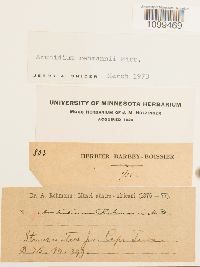 Archidium rehmannii Mitt. 619479[1099469]Rehmann, A. 803 South Africa, Cape, near Cape Town |
MIN:Bryophytes | 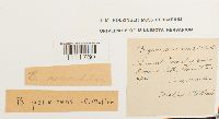 Bryum mundtii Müll. Hal. 639300[1111760]MacOwen s.n. South Africa, Boschberg Mountain |
MIN:Bryophytes | 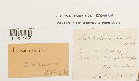 Ditrichum difficile (Duby) M. Fleisch. 646487[1125147]MacOwan s.n. South Africa, Eastern Cape, Somerset East, The Boschberg |
MIN:Bryophytes | 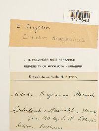 Entodon dregeanus (Hornsch.) Müll. Hal. 643153[1126648]Oeflestad, L.M. s.n.1910-01-00 South Africa, Nkandla, Ekombe |
MIN:Bryophytes | 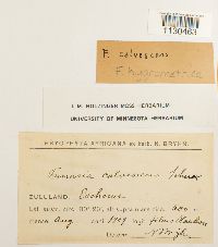 Funaria hygrometrica Hedw. 642862[1130463]Bryhn, N. s.n.1909-08-00 South Africa, formerly Zululand, 600m |
MIN:Bryophytes | 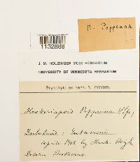 Hookeriopsis pappeana (Hampe) A. Jaeger 644762[1132888]Bryhn, N. s.n.1908-04-00 South Africa, Zululand |
MIN:Bryophytes | 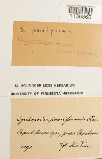 Hypodontium pomiforme (Hook.) Müll. Hal. 650079[1136360]Laux, Miss [?] s.n.1891-00-00 South Africa, near Cape Town |
MIN:Bryophytes | 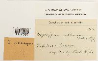 Isopterygium subleucopsis Broth. & Bryhn 646341[1136597]Bryhn s.n.1909-08-00 South Africa, Zululand |
MIN:Bryophytes | 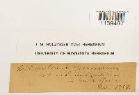 646463[1139497] s.n.1889-12-00 South Africa |
MIN:Bryophytes | 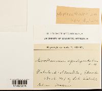 Mittenothamnium horridulum (Broth.) Cardot 647021[1142074]Titlestad, L.M. s.n.1907-11-00 South Africa, Zululand: Nkandhla, Ekombe |
MIN:Bryophytes | 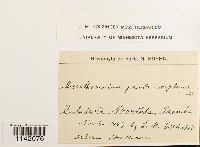 Mittenothamnium pseudoreptans (Müll. Hal.) Cardot 647029[1142076]Titlestad, L.M. s.n.1907-11-00 South Africa, Zululand: Nkandhla, Ekombe |
MIN:Bryophytes |  648250[1151322]Titlestad, L.M. s.n.1910-01-00 South Africa, Zululand: Nkandhla, Ekombe, 1300m |
MIN:Bryophytes |  Ptilium crista-castrensis (Hedw.) De Not. 645327[1159921] 191890-00-00 South Africa |
MIN:Bryophytes |  Porothamnium comorense (Hampe ex Müll. Hal.) Sim 650235[1157837] 1909-00-00 South Africa, Zululand, 600m |
1
Page 1, records 1-15 of 15
Google Map
Google Maps is a web mapping service provided by Google that features a map that users can pan (by dragging the mouse) and zoom (by using the mouse wheel). Collection points are displayed as colored markers that when clicked on, displays the full information for that collection. When multiple species are queried (separated by semi-colons), different colored markers denote each individual species.